Eugene/Springfield Crime (2024)
This is the 2024 update to last year's Eugene/Springfield crime report.
Numbers are derived from calls published on the EPD and SPD dispatch logs.
Note that not all calls are published (e.g. Suicidal Subject), not all calls result in dispatch of an officer, and not all calls are actionable (i.e. an officer is dispatched, but the person/problem is not found).
Daily crime map available here.
All Calls (except Traffic Stops)
undefined
         Year   Eugene        Springfield
    ------ ------------- ---------------
     2014   50,042         28,534
     2015   51,669 +3.3%   28,772  +0.8%
     2016   51,366 -0.6%   29,838  +3.7
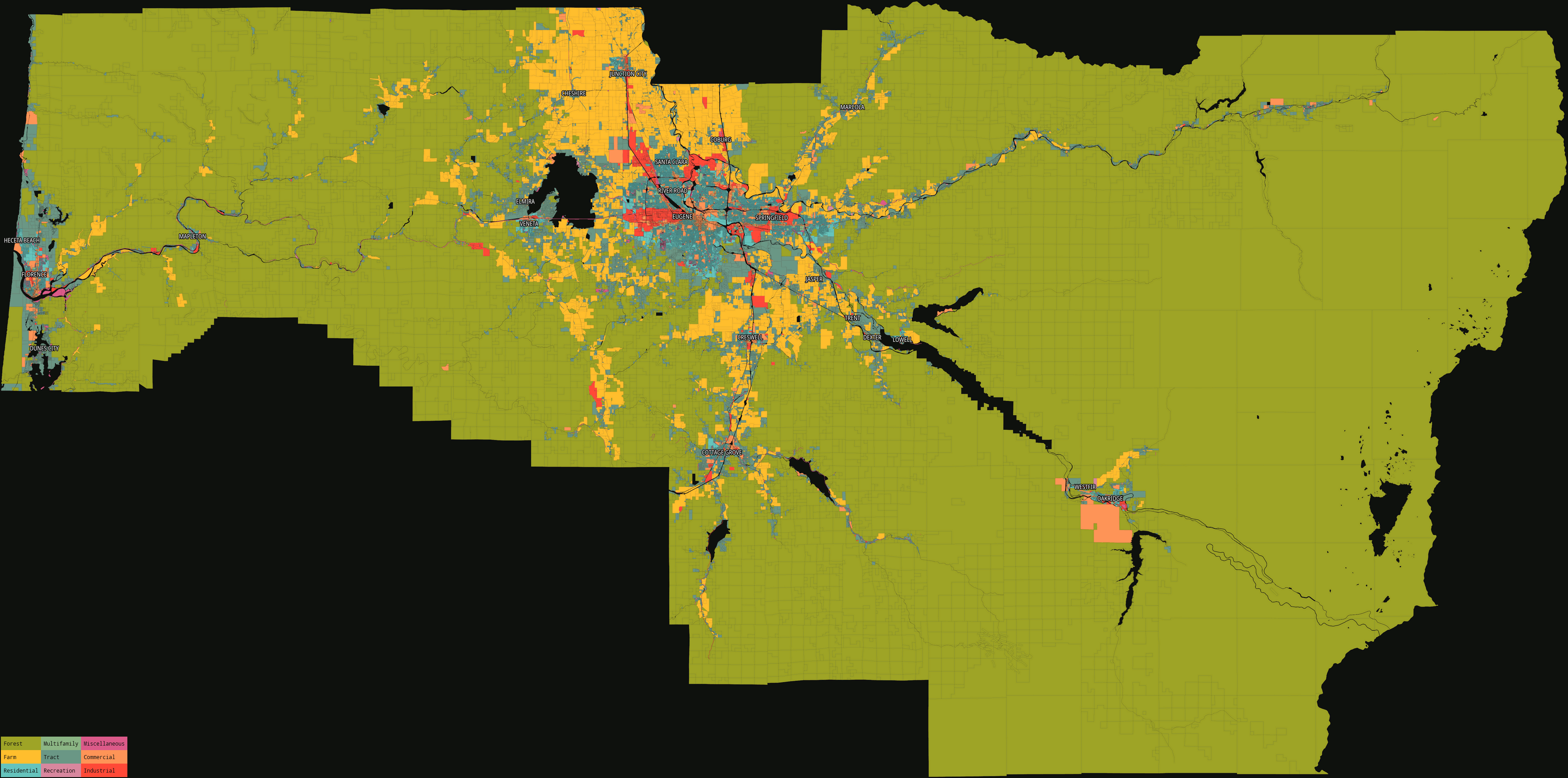
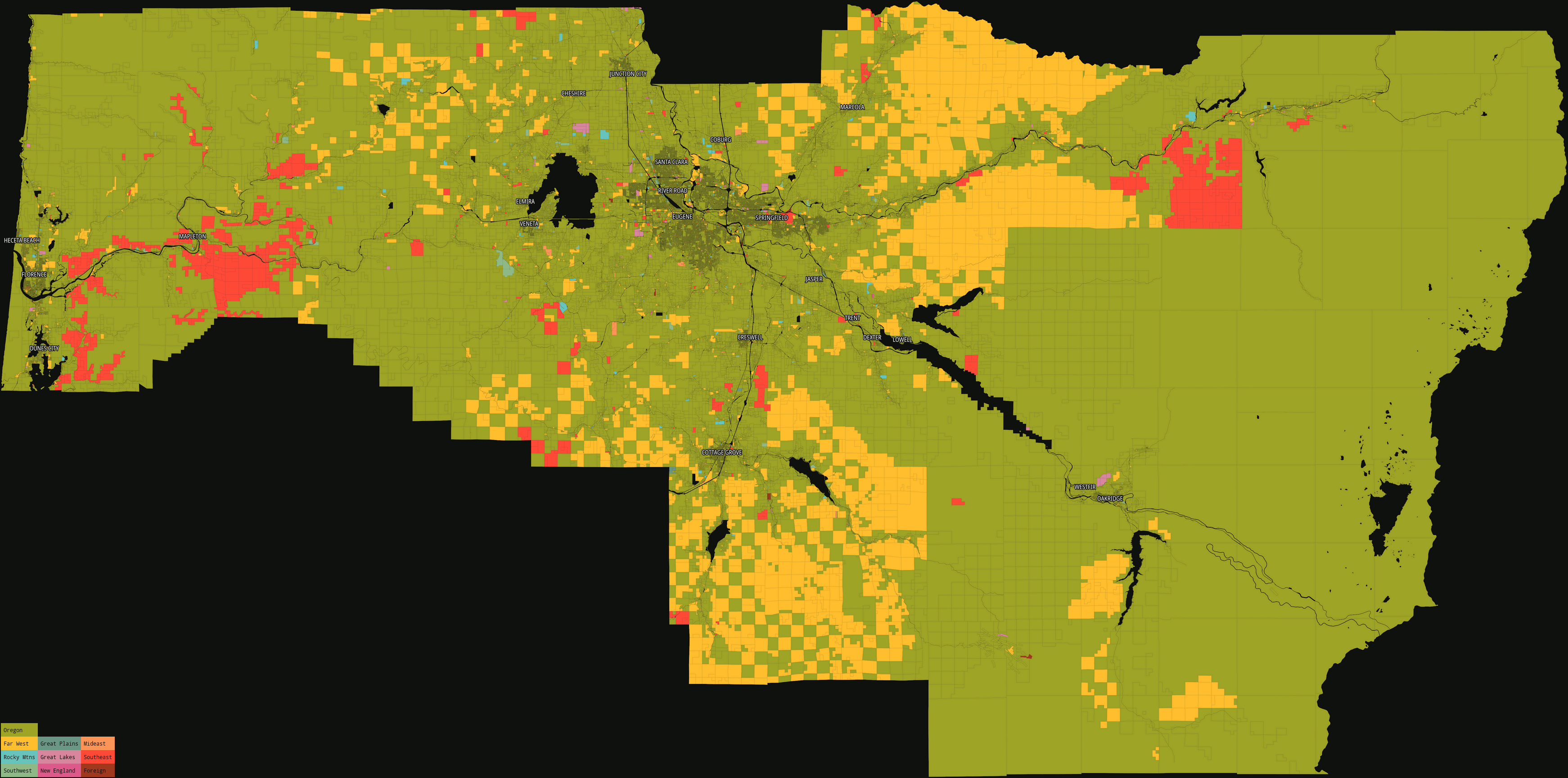
Lane County Landlords
Lane County has an excellent portal to parcel maps and property owner data. Visualizing this data at a higher level reveals interesting features wrt land use and ownership.
Interactive maps and tables are here.
County map, by property class (3484×1729, 703kB):
County map, identifying out-of-state land owners by classifying by region/state (3484×1729, 741kB):
Large map, Springfield-Eugene area, by property class, without legend (5000×2728, 2.7MB):
[![](https: